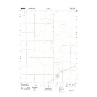
2011 Map of Venango
USGS Topo · Published 2011About this map
Venango stands as the primary hub of activity in this 2011 survey of the western Nebraska borderlands. Located in Perkins County, the village is centered around the Venango Post Office and a grid of residential streets like Mercer St. The surrounding landscape is defined by the gradual, intermittent flow of Spring Creek and Sand Creek, which carve subtle drainage patterns across the high plains terrain. This map captures the intersection of rural life and systematic land organization, with a dense network of county roads such as Co Rd-18 and Co Rd-57 forming a strict mile-by-mile lattice. The survey documents the area just as it appeared in the early 21st century, illustrating the enduring agricultural layout of the Nebraska-Colorado line.
Find a feature on this map
19 named features on this map. Tap any name to fly to it.
Don’t see what you’re looking for? This feature index may not catch every label — zoom into the map to look around manually.
Map Details
Editions of this 2011 Venango Map
This is the sole edition of this map. No revisions or reprints were ever made.
Other maps of this area

1954 · Sterling
USGS Topo · 1:250,000

1954 · McCook
USGS Topo · 1:250,000

1957 · McCook
USGS Topo · 1:250,000

1958 · McCook
USGS Topo · 1:250,000

1958 · Sterling
USGS Topo · 1:250,000

1961 · Brandon NW
USGS Topo · 1:24,000

1961 · Lamar NW
USGS Topo · 1:24,000

1961 · Brandon
USGS Topo · 1:24,000

1962 · Venango SW
USGS Topo · 1:24,000
1962 · Venango NE
USGS Topo · 1:24,000