
1961 Map of Lamar NW
USGS Topo · Published 1963About this map
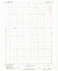
Greenfield Ch stands as a focal point in the rural landscape along the boundary of Perkins Co and Chase Co during the early 1960s. This survey, part of a Department of the Interior program for the development of the Missouri River Basin, reveals a highly structured agricultural grid characterized by township and range subdivisions. Large designated areas such as Grace, Lisbon, Jamestown, and Macedonia reflect the historical organization of the plains, likely corresponding to early precinct or township names. The terrain is marked by gentle undulations and a network of section roads, showing the footprint of rural settlement and land use before later twentieth-century consolidations. Researchers can trace the precise location of the country church and the early political divisions that defined this corner of Nebraska.
Find a feature on this map
6 named features on this map. Tap any name to fly to it.
Don’t see what you’re looking for? This feature index may not catch every label — zoom into the map to look around manually.
Map Details
Editions of this 1961 Lamar NW Map
2 editions found
Other maps of this area

1954 · Sterling
USGS Topo · 1:250,000

1954 · McCook
USGS Topo · 1:250,000

1957 · McCook
USGS Topo · 1:250,000

1958 · McCook
USGS Topo · 1:250,000

1958 · Sterling
USGS Topo · 1:250,000

1961 · Lamar NE
USGS Topo · 1:24,000

1961 · Lamar
USGS Topo · 1:24,000

1961 · Brandon SE
USGS Topo · 1:24,000

1961 · Brandon
USGS Topo · 1:24,000

1962 · Amherst NE
USGS Topo · 1:24,000