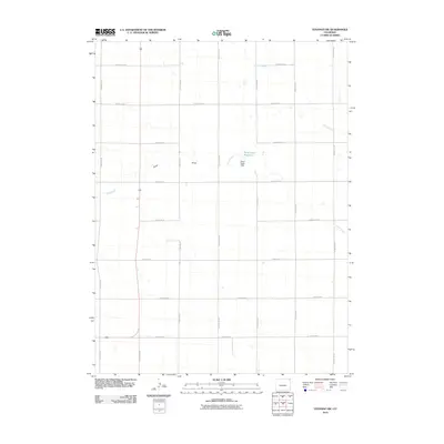
2010 Map of Venango SW
USGS Topo · Published 2010About this map
Sand Creek Reservoir and the accompanying Sand Creek Dam anchor the northeast quadrant of this landscape, situated at the edge of the Sand Draw terrain. This 2010 survey by the U.S. Geological Survey reveals a strictly organized agricultural grid in Sedgwick County, defined by a dense network of county roads. The terrain is primarily characterized by the intermittent drainage of Spring Creek and Sand Creek, which carve subtle depressions through the high plains. The intersection of local infrastructure with these water features highlights the precision of western land management, where roads like County Rd-14 and County Rd-49 strictly follow section lines regardless of the underlying topography.
Find a feature on this map
20 named features on this map. Tap any name to fly to it.
Don’t see what you’re looking for? This feature index may not catch every label — zoom into the map to look around manually.
Map Details
Editions of this 2010 Venango SW Map
This is the sole edition of this map. No revisions or reprints were ever made.
Other maps of this area

1952 · Julesburg SE
USGS Topo · 1:24,000

1953 · Julesburg
USGS Topo · 1:24,000

1954 · Sterling
USGS Topo · 1:250,000

1958 · Sterling
USGS Topo · 1:250,000

1962 · Venango SW
USGS Topo · 1:24,000
1962 · Venango NE
USGS Topo · 1:24,000

1962 · Holyoke NE
USGS Topo · 1:24,000

1962 · Amherst
USGS Topo · 1:24,000
1962 · Venango NW
USGS Topo · 1:24,000

1962 · Amherst NE
USGS Topo · 1:24,000