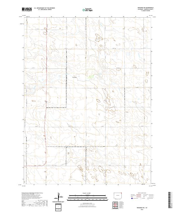
2022 Map of Venango SW
USGS Topo · Published 2022About this map
The landscape of northeastern Sedgwick County, Colorado, is defined by the ephemeral drainage patterns of the High Plains. This part of the state features the Sand Draw, a prominent topographic depression that channels seasonal moisture toward the Sand Cr Reservoir. The layout of the region follows the strict Public Land Survey System grid, which is clearly visible through the network of county roads like Co Rd 45 and Co Rd 49 that segment the townships of t10n r44w and t10n r43w. Periodic waterways such as Spring Cr and Sand Cr cut across this agricultural and ranching terrain, illustrating the critical importance of water management in this arid environment. The map provides a precise look at the rural infrastructure and land divisions that have persisted through generations of land use in this corner of Colorado.
Find a feature on this map
23 named features on this map. Tap any name to fly to it.
Don’t see what you’re looking for? This feature index may not catch every label — zoom into the map to look around manually.
Map Details
Editions of this 2022 Venango SW Map
This is the sole edition of this map. No revisions or reprints were ever made.
Other maps of this area

1952 · Julesburg SE
USGS Topo · 1:24,000

1953 · Julesburg
USGS Topo · 1:24,000

1954 · Sterling
USGS Topo · 1:250,000

1958 · Sterling
USGS Topo · 1:250,000

1962 · Venango SW
USGS Topo · 1:24,000
1962 · Venango NE
USGS Topo · 1:24,000

1962 · Holyoke NE
USGS Topo · 1:24,000

1962 · Amherst
USGS Topo · 1:24,000
1962 · Venango NW
USGS Topo · 1:24,000

1962 · Amherst NE
USGS Topo · 1:24,000