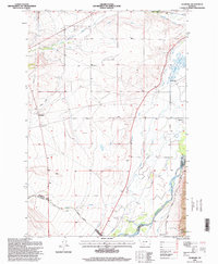
1996 Map of Vendome
USGS Topo · Published 1998About this map
Jefferson River valley agriculture and irrigation systems define this high-country landscape, where the Parrot Ditch and Jefferson Canal trace the contours of the basin. The settlement of Piedmont sits at a crossroads of water and rail, while further south, the Fish Creek Cem remains a quiet landmark near the junction of Fish Creek and the river. This survey captures a sophisticated network of water management, including the Delmoe Ditch and the Jefferson Valley Canal, essential for the ranching and farming operations that sustain the valley floor.
Find a feature on this map
25 named features on this map. Tap any name to fly to it.
Don’t see what you’re looking for? This feature index may not catch every label — zoom into the map to look around manually.
Map Details
Editions of this 1996 Vendome Map
This is the sole edition of this map. No revisions or reprints were ever made.
Other maps of this area

1893 · Dillon
USGS Topo · 1:250,000

1955 · Dillon
USGS Topo · 1:250,000

1957 · Dillon
USGS Topo · 1:250,000

1958 · Dillon
USGS Topo · 1:250,000

1960 · Twin Bridges
USGS Topo · 1:62,500

1960 · Waterloo
USGS Topo · 1:62,500

1962 · Dillon
USGS Topo · 1:250,000
1963 · Dry Mountain
USGS Topo · 1:24,000
1963 · Whitehall
USGS Topo · 1:24,000
1963 · Black Butte
USGS Topo · 1:24,000