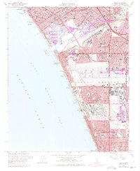
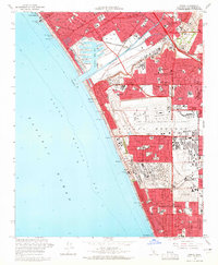
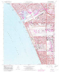
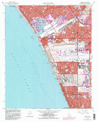
1964 Map of Venice
USGS Topo · Published 1975About this map
The coastline of Santa Monica Bay is defined here by the rapid mid-century expansion of the Westside and South Bay. Los Angeles International Airport dominates the central landscape, showing its massive layout adjacent to industrial zones and the Sausal Redondo land grant area. To the north, the intricate canal-side layout of Venice and the burgeoning Culver City meet at Ballona Creek, while Loyola University stands prominently on the bluffs overlooking the wetlands.
Find a feature on this map
68 named features on this map. Tap any name to fly to it.
Don’t see what you’re looking for? This feature index may not catch every label — zoom into the map to look around manually.
Map Details
Editions of this 1964 Venice Map
4 editions found
Other maps of this area

1894 · Los Angeles
USGS Topo · 1:62,500

1896 · Redondo
USGS Topo · 1:62,500

1896 · Santa Monica
USGS Topo · 1:62,500

1898 · Santa Monica
USGS Topo · 1:62,500

1900 · Los Angeles
USGS Topo · 1:62,500

1901 · Southern California Sheet No. 1
USGS Topo · 1:250,000

1902 · Santa Monica
USGS Topo · 1:62,500

1903 · Calabasas
USGS Topo · 1:62,500

1903 · Camulos
USGS Topo · 1:125,000

1904 · Southern California Sheet No. 1
USGS Topo · 1:250,000