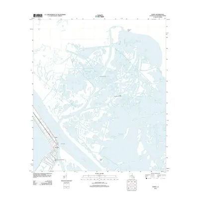
2012 Map of Venice
USGS Topo · Published 2012About this map
Venice and Orchard stand at the southern tip of the Mississippi Delta, marking a transition from solid land to the sprawling estuarine network of Plaquemines Parish. This maritime landscape is defined by the heavy presence of the energy industry, with the Grand Bay Oil Field and the Block 47 Oil and Gas Field dotting the waters of the Gulf of Mexico. Navigation and transportation in this amphibious environment rely on specialized facilities like the Chevron USA Incorporated Seaplane Base and the Grand Bay Seaplane Base.
Find a feature on this map
30 named features on this map. Tap any name to fly to it.
Don’t see what you’re looking for? This feature index may not catch every label — zoom into the map to look around manually.
Map Details
Editions of this 2012 Venice Map
This is the sole edition of this map. No revisions or reprints were ever made.
Other maps of this area

1893 · East Delta
USGS Topo · 1:62,500

1893 · Forts
USGS Topo · 1:62,500

1893 · West Delta
USGS Topo · 1:62,500

1935 · Taylor Pass
USGS Topo · 1:31,680

1946 · Pass Tante Phine
USGS Topo · 1:31,680

1947 · Pass A Loutre West
USGS Topo · 1:31,680

1947 · Venice
USGS Topo · 1:31,680

1947 · Fort St. Philip
USGS Topo · 1:31,680

1947 · Main Pass
USGS Topo · 1:31,680

1948 · Forts
USGS Topo · 1:62,500