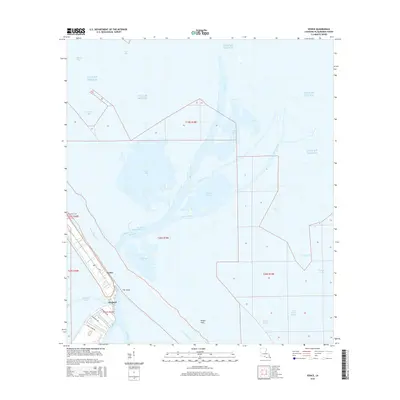
2015 Map of Venice
USGS Topo · Published 2015About this map
Venice stands at the terminus of La 23, marking a critical juncture where the solid land of the Mississippi delta dissolves into a complex web of bays and bayous. This survey details the precarious geography of the lower Plaquemines Parish peninsula, showing the industrial footprints along Coast Guard Rd and McDermott Rd that serve the offshore and river economies. The landscape is defined by the massive flow of the Mississippi River and its numerous distributaries, including The Jump and Baptiste Collette Bayou. To the east and west, the map records an intricate coastal environment featuring Wilder Flats, Benneys Bay, and Yaratich Bend. Local history is anchored by the Boothville Cem and the settlement of Orchard, located just upstream from the branching waterways of Spanish Pass and Tiger Pass.
Find a feature on this map
35 named features on this map. Tap any name to fly to it.
Don’t see what you’re looking for? This feature index may not catch every label — zoom into the map to look around manually.
Map Details
Editions of this 2015 Venice Map
This is the sole edition of this map. No revisions or reprints were ever made.
Other maps of this area

1893 · East Delta
USGS Topo · 1:62,500

1893 · Forts
USGS Topo · 1:62,500

1893 · West Delta
USGS Topo · 1:62,500

1935 · Taylor Pass
USGS Topo · 1:31,680

1946 · Pass Tante Phine
USGS Topo · 1:31,680

1947 · Pass A Loutre West
USGS Topo · 1:31,680

1947 · Venice
USGS Topo · 1:31,680

1947 · Fort St. Philip
USGS Topo · 1:31,680

1947 · Main Pass
USGS Topo · 1:31,680

1948 · Forts
USGS Topo · 1:62,500