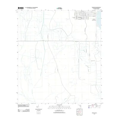
2012 Map of Venus NW
USGS Topo · Published 2012About this map
Placid Lakes occupies the northeastern corner of this landscape, its residential grid defined by aviation-oriented infrastructure and thoroughfares like Placid Lakes Blvd. The community's development is closely tied to its proximity to Lake Placid and a network of local airstrips, including Placid Lakes Airport, Kings Port Airport, and the Vince's Condominium Association Airport. South and west of these settlements, the landscape transitions into ranch land and wetlands. The drainage of Fisheating Creek and Bootheel Cr patterns the territory, while rural landmarks such as Carlton Ranch and Lightsey Ranch Rd indicate the area's agricultural character. Remote tracks like Footman Trl offer a glimpse into the interior topography of Highlands County during this era of modern mapping.
Find a feature on this map
37 named features on this map. Tap any name to fly to it.
Don’t see what you’re looking for? This feature index may not catch every label — zoom into the map to look around manually.
Map Details
Editions of this 2012 Venus NW Map
This is the sole edition of this map. No revisions or reprints were ever made.
Other maps of this area

1952 · Lake Placid
USGS Topo · 1:24,000

1953 · Lake June In Winter
USGS Topo · 1:24,000

1953 · Venus NW
USGS Topo · 1:24,000

1953 · Crewsville SE
USGS Topo · 1:24,000

1953 · Childs
USGS Topo · 1:24,000

1956 · Fort Pierce
USGS Topo · 1:250,000

1957 · Long Island Marsh SE
USGS Topo · 1:24,000

1957 · Venus
USGS Topo · 1:24,000

1957 · Venus SW
USGS Topo · 1:24,000

1957 · Long Island Marsh NE
USGS Topo · 1:24,000