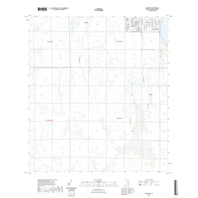
2021 Map of Venus NW
USGS Topo · Published 2021About this map
Placid Lakes serves as the primary residential hub in this corner of the Florida peninsula, defined by its intricate grid of streets and specialized aviation facilities. The community is anchored by the Placid Lakes Airport and bordered to the east by the shores of Lake Placid. Moving away from the developed core, the landscape transitions into the expansive wetlands and scrub typical of the Lake Wales Ridge physiographic region. This area is drained by a network of seasonal watercourses, most notably the meandering Fisheating Creek and Bootheel Cr. To the north, the small settlement of Hicoria stands near the boundary of large rural tracts. The map reveals a land managed for both habitation and conservation, where suburban development abruptly meets the vast, low-lying drainage basins that define the local ecology.
Find a feature on this map
47 named features on this map. Tap any name to fly to it.
Don’t see what you’re looking for? This feature index may not catch every label — zoom into the map to look around manually.
Map Details
Editions of this 2021 Venus NW Map
This is the sole edition of this map. No revisions or reprints were ever made.
Other maps of this area

1952 · Lake Placid
USGS Topo · 1:24,000

1953 · Lake June In Winter
USGS Topo · 1:24,000

1953 · Venus NW
USGS Topo · 1:24,000

1953 · Crewsville SE
USGS Topo · 1:24,000

1953 · Childs
USGS Topo · 1:24,000

1956 · Fort Pierce
USGS Topo · 1:250,000

1957 · Long Island Marsh SE
USGS Topo · 1:24,000

1957 · Venus
USGS Topo · 1:24,000

1957 · Venus SW
USGS Topo · 1:24,000

1957 · Long Island Marsh NE
USGS Topo · 1:24,000