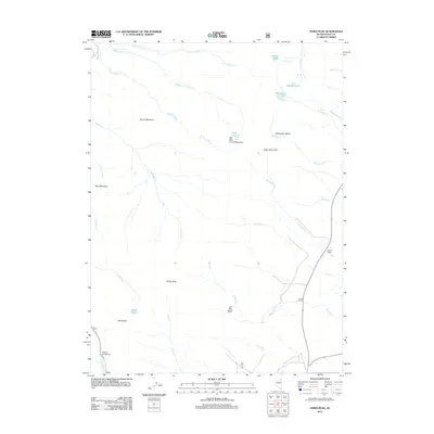
2012 Map of Verdi Peak
USGS Topo · Published 2012About this map
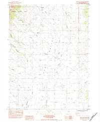
Verdi Peak and Smith Peak anchor this high-altitude landscape in the Ruby Mountains during the early 21st century. The terrain is defined by a series of alpine glacial features, including Robinson Lake, Verdi Lake, and the clustered Soldier Lakes. The hydrography is characterized by numerous seasonal and perennial forks, such as Middle Fork Cold Cr and S Fork Cold Cr, which carve through basins like Withington Basin. Historical land use is evidenced by the presence of Sharp Ranch and North Ranch along the eastern edge, while the southwestern corner provides recreational access at Terraces Campground near Lamoille Cr. This 2012 survey illustrates the relationship between the dramatic vertical relief of summits like Bald Mountain and the water sources that sustain the lower ranching operations.
Find a feature on this map
36 named features on this map. Tap any name to fly to it.
Don’t see what you’re looking for? This feature index may not catch every label — zoom into the map to look around manually.
Map Details
Editions of this 2012 Verdi Peak Map
This is the sole edition of this map. No revisions or reprints were ever made.
Other maps of this area

1935 · Halleck
USGS Topo · 1:125,000

1955 · Elko
USGS Topo · 1:250,000

1958 · Elko
USGS Topo · 1:250,000

1962 · Elko
USGS Topo · 1:250,000

1962 · Lamoille
USGS Topo · 1:62,500

1965 · Elko
USGS Topo · 1:250,000
1969 · Secret Valley
USGS Topo · 1:24,000
1970 · Soldier Peak
USGS Topo · 1:24,000
1971 · Halleck SW
USGS Topo · 1:24,000
1984 · Ruby City Creek
USGS Topo · 1:24,000