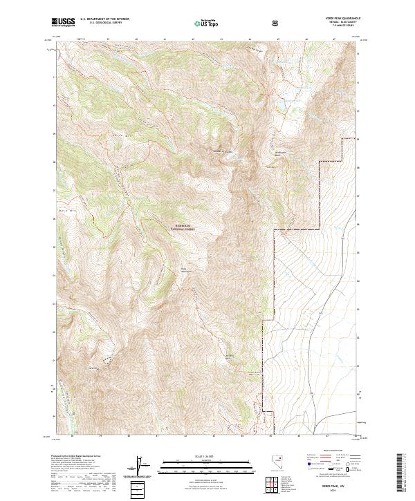
2021 Map of Verdi Peak
USGS Topo · Published 2021About this map
The Ruby Mountains dominate this high-altitude landscape within the Humboldt National Forest, characterized by steep glaciated basins and prominent summits. The terrain is marked by distinct peaks such as Verdi Peak, Smith Peak, and Horse Mtn, which overlook a network of alpine water bodies including Robinson Lake, Verdi Lake, and the Soldier Lakes. The drainage patterns here are complex, with numerous forks of Middle Fork Cold Cr and North Fork Cold Cr carving through the mountain faces.
Find a feature on this map
51 named features on this map. Tap any name to fly to it.
Don’t see what you’re looking for? This feature index may not catch every label — zoom into the map to look around manually.
Map Details
Editions of this 2021 Verdi Peak Map
This is the sole edition of this map. No revisions or reprints were ever made.
Other maps of this area

1935 · Halleck
USGS Topo · 1:125,000

1955 · Elko
USGS Topo · 1:250,000

1958 · Elko
USGS Topo · 1:250,000

1962 · Elko
USGS Topo · 1:250,000

1962 · Lamoille
USGS Topo · 1:62,500

1965 · Elko
USGS Topo · 1:250,000
1969 · Secret Valley
USGS Topo · 1:24,000
1970 · Soldier Peak
USGS Topo · 1:24,000
1971 · Halleck SW
USGS Topo · 1:24,000
1984 · Ruby City Creek
USGS Topo · 1:24,000