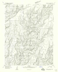
1958 Map of Verdure 4 SE
USGS Topo · Published 1958About this map
Bug Point and the dramatic canyon systems of southeastern Utah define this landscape during the mid-1950s. The terrain is marked by a network of deep incisions including Lake Canyon, Squaw Canyon, and Papoose Canyon, which cut through the high plateau country. This area along the Utah-Colorado border preserves evidence of ancient habitation, with several sites labeled simply as Ruins found near the heads of Ross Canyon and Ruin Canyon.
Find a feature on this map
17 named features on this map. Tap any name to fly to it.
Don’t see what you’re looking for? This feature index may not catch every label — zoom into the map to look around manually.
Map Details
Editions of this 1958 Verdure 4 SE Map
This is the sole edition of this map. No revisions or reprints were ever made.
Other maps of this area

1886 · Abajo
USGS Topo · 1:250,000

1892 · Abajo
USGS Topo · 1:250,000

1893 · Abajo
USGS Topo · 1:250,000

1955 · Verdure 4 NW
USGS Topo · 1:24,000

1955 · Verdure 4 SW
USGS Topo · 1:24,000

1956 · Cortez
USGS Topo · 1:250,000

1957 · Moqui NW
USGS Topo · 1:24,000

1957 · Cedar 3 NW
USGS Topo · 1:24,000

1957 · Aneth 1 NE
USGS Topo · 1:24,000

1957 · Cedar 3 SW
USGS Topo · 1:24,000