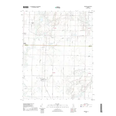
2018 Map of Vergennes
USGS Topo · Published 2018About this map
The village of Vergennes sits at a crossroads in Jackson County, where the southern Illinois prairie is deeply etched by a network of drainage creeks. Numerous family and community burial grounds, such as Tuthill Cem, McElvain Cem, and Parrish Cem, are scattered across the landscape, marking the enduring footprint of rural lineages in the T6S and T7S townships. To the north, the Pinckneyville-Du Quoin Airport provides a modern utility near the small settlement of Matthews, while Matthews Junction hints at the region's historic transportation hubs. The terrain is defined by the winding courses of Beaucoup Creek and Youngs Creek, which flow through a grid of secondary roads like Dowell Rd and Zoller Rd. This survey documents a quiet agricultural landscape where small-town clusters remain centered around historical cemetery sites and the local water system.
Find a feature on this map
77 named features on this map. Tap any name to fly to it.
Don’t see what you’re looking for? This feature index may not catch every label — zoom into the map to look around manually.
Map Details
Editions of this 2018 Vergennes Map
This is the sole edition of this map. No revisions or reprints were ever made.
Other maps of this area

1910 · Herrin
USGS Topo · 1:62,500

1910 · Murphysboro
USGS Topo · 1:62,500

1924 · Pinckneyville
USGS Topo · 1:62,500

1926 · Pinckneyville
USGS Topo · 1:62,500

1926 · Duquoin
USGS Topo · 1:62,500

1936 · Herrin
USGS Topo · 1:62,500

1938 · Murphysboro
USGS Topo · 1:62,500

1949 · Paducah
USGS Topo · 1:250,000

1950 · Paducah
USGS Topo · 1:250,000

1954 · Paducah
USGS Topo · 1:250,000