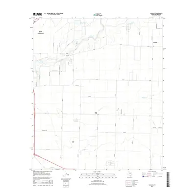
2016 Map of Veribest
USGS Topo · Published 2016About this map
The Concho River winds through the northern portion of this landscape, its path shaped by the Kaase Reservoir and Johnson Lake. This region on the eastern edge of San Angelo reflects a transition from suburban development to the agricultural expanse of the Lipan Flat. The settlement of Veribest, located at the junction of several rural routes including E Veribest Rd and FM 2334, serves as a local hub for the surrounding ranching and farming community.
Find a feature on this map
56 named features on this map. Tap any name to fly to it.
Don’t see what you’re looking for? This feature index may not catch every label — zoom into the map to look around manually.
Map Details
Editions of this 2016 Veribest Map
This is the sole edition of this map. No revisions or reprints were ever made.
Other maps of this area

1891 · Hayrick
USGS Topo · 1:125,000

1892 · San Angelo
USGS Topo · 1:125,000

1894 · Hayrick
USGS Topo · 1:125,000

1924 · San Angelo 2-c
USGS Topo · 1:48,000

1924 · San Angelo 2-b
USGS Topo · 1:48,000

1928 · Wall
USGS Topo · 1:62,500

1954 · San Angelo
USGS Topo · 1:250,000

1957 · Eola
USGS Topo · 1:62,500

1957 · Miles
USGS Topo · 1:62,500
1957 · San Angelo South
USGS Topo · 1:24,000