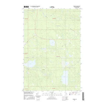
2017 Map of Vermilac
USGS Topo · Published 2017About this map
The settlement of Vermilac serves as the central point in this Upper Peninsula landscape, where a intricate network of waterways defines the territory in Baraga County. The Vermilac River flows through the area, connecting several significant bodies of water including Worm Lake and Parent Lake. To the north, the terrain is marked by the dramatic descent of the Sturgeon River, which features Upper Falls, Lower Falls, and Canyon Falls in close proximity. This 2017 survey illustrates the enduring wilderness character of the region, crisscrossed by the N Country Trail and historical transit corridors like Old US Hwy 41 and Old M-28. The distribution of wetlands and lakes, such as King Lake and Delene Lake, suggests a landscape primarily shaped by timber and water resources, with legacy road names like N Kantola Rd hinting at the area's local history.
Find a feature on this map
30 named features on this map. Tap any name to fly to it.
Don’t see what you’re looking for? This feature index may not catch every label — zoom into the map to look around manually.
Map Details
Editions of this 2017 Vermilac Map
This is the sole edition of this map. No revisions or reprints were ever made.
Other maps of this area

1895 · Ned Lake
USGS Topo · 1:62,500

1895 · Perch Lake
USGS Topo · 1:62,500

1954 · Perch Lake
USGS Topo · 1:62,500

1954 · Sidnaw
USGS Topo · 1:62,500

1955 · Ned Lake
USGS Topo · 1:62,500

1955 · Herman
USGS Topo · 1:62,500

1958 · Iron River
USGS Topo · 1:250,000

1960 · Iron River
USGS Topo · 1:250,000

1961 · Iron River
USGS Topo · 1:250,000

1967 · Iron River
USGS Topo · 1:250,000