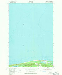
1951 Map of Vermilion
USGS Topo · Published 1971About this map
Lake Superior dominates the northern expanse of this 1950s coastal survey, where the rugged shoreline of Michigan's Upper Peninsula meets the deep waters of the Great Lakes. The small settlement of Vermilion serves as the primary landmark on this remote stretch, situated near a prominent Tower that likely aided maritime navigation or fire lookout duties. The interior is characterized by the dense woodlands of the Whitefish State Forest, a landscape defined by its complex hydrology of small lakes and winding drainage systems. Unique local names such as Weatherhogs Lake and Twomile Lake suggest a history of local woodsmen and early residents who navigated these isolated wetlands. The map also delineates the jurisdictional boundary between Luce Co and Chippewa Co, cutting through the timberland and low-lying marshes near Browns Lake.
Find a feature on this map
10 named features on this map. Tap any name to fly to it.
Don’t see what you’re looking for? This feature index may not catch every label — zoom into the map to look around manually.
Map Details
Editions of this 1951 Vermilion Map
2 editions found
Other maps of this area

1951 · Vermilion SE
USGS Topo · 1:24,000

1951 · Shelldrake
USGS Topo · 1:24,000

1951 · Vermilion
USGS Topo · 1:24,000

1951 · Sheephead Lake
USGS Topo · 1:24,000

1951 · Shelldrake
USGS Topo · 1:62,500

1954 · Sault Sainte Marie
USGS Topo · 1:250,000

1956 · Sault Sainte Marie
USGS Topo · 1:250,000

1957 · Sault Sainte Marie
USGS Topo · 1:250,000

1958 · Sault Sainte Marie
USGS Topo · 1:250,000
1968 · Betsy Lake North
USGS Topo · 1:24,000