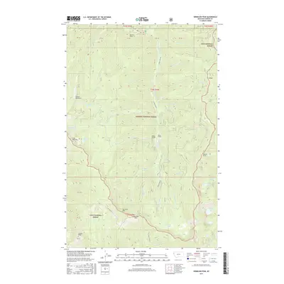
2017 Map of Vermilion Peak
USGS Topo · Published 2017About this map
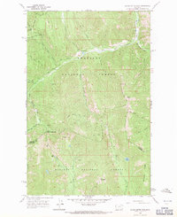
The Vermilion River carves a central path through this high-altitude landscape where the Lolo National Forest and Kaniksu National Forest meet. This 2017 survey documents a wilderness of sharp ridgelines and glacial basins, anchored by Vermilion Peak and Graves Peak in the south. The terrain is defined by its dramatic elevation changes, rising from the river valley to the peaks of the Cabinet Mountains in the west. Numerous alpine water bodies, including Rush Lake, Stony Lake, and Image Lake, occupy the high cirques, while a network of forest service roads like Graves Creek Rd and Irus Creek Rd provide the only significant human infrastructure. This map is a primary resource for understanding the contemporary topography and forest management boundaries in Sanders County, tracing the legacy of these protected public lands.
Find a feature on this map
40 named features on this map. Tap any name to fly to it.
Don’t see what you’re looking for? This feature index may not catch every label — zoom into the map to look around manually.
Map Details
Editions of this 2017 Vermilion Peak Map
This is the sole edition of this map. No revisions or reprints were ever made.
Other maps of this area

1937 · Thompson Falls
USGS Topo · 1:125,000

1937 · Thompson Falls
USGS Topo · 1:62,500

1956 · Wallace
USGS Topo · 1:250,000

1957 · Thompson Falls
USGS Topo · 1:62,500

1960 · Wallace
USGS Topo · 1:250,000
1964 · Priscilla Peak
USGS Topo · 1:24,000

1966 · Vermilion Peak
USGS Topo · 1:24,000
1966 · Seven Point Mountain
USGS Topo · 1:24,000
1966 · Miller Lake
USGS Topo · 1:24,000
1966 · Silver Butte Pass
USGS Topo · 1:24,000