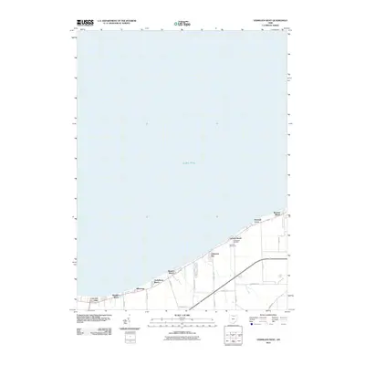
2010 Map of Vermilion West
USGS Topo · Published 2010About this map
Lake Erie defines the northern edge of this coastal survey, where a series of residential enclaves and summer communities line the shore between the open water and agricultural hinterlands. The landscape is characterized by its linear development, with settlements like Mitiwanga, Heidelberg Beach, and Beulah Beach established along the lakefront. Further east, the Vermilion Golf Course and the Cuddleback Cemetery provide central landmarks for the surrounding neighborhoods of Orchard Beach and Volunteer Bay. The inland area transition into a grid of rural roads, including Joppa Rd and Darrow Rd, which service the farm plots south of the lakeside developments. At the western edge, the intersection at Colonial Ceylon Villa Junction marks a key point for those traveling toward Ruggles Beach.
Find a feature on this map
25 named features on this map. Tap any name to fly to it.
Don’t see what you’re looking for? This feature index may not catch every label — zoom into the map to look around manually.
Map Details
Editions of this 2010 Vermilion West Map
This is the sole edition of this map. No revisions or reprints were ever made.
Other maps of this area

1903 · Vermilion
USGS Topo · 1:62,500

1904 · Sandusky
USGS Topo · 1:62,500

1916 · Kelleys Island
USGS Topo · 1:62,500

1919 · Kelleys Island
USGS Topo · 1:62,500

1956 · Toledo
USGS Topo · 1:250,000

1959 · Milan
USGS Topo · 1:24,000

1959 · Berlin Heights
USGS Topo · 1:24,000

1959 · Vermilion East
USGS Topo · 1:24,000

1959 · Vermilion West
USGS Topo · 1:24,000

1959 · Kipton
USGS Topo · 1:24,000