
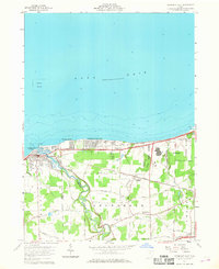
1959 Map of Vermilion East
USGS Topo · Published 1960About this map
The Vermilion River snakes through the western edge of this lakeshore landscape, defining the boundary between Erie and Lorain counties before emptying into Lake Erie. In the late 1950s, this area reflects a blend of established lakeside communities and active transit corridors. Residential developments like Elberta Beach and Vermilion-on-the-Lake line the shore, while the interior remains dominated by orchards and open fields.
Find a feature on this map
41 named features on this map. Tap any name to fly to it.
Don’t see what you’re looking for? This feature index may not catch every label — zoom into the map to look around manually.
Map Details
Editions of this 1959 Vermilion East Map
2 editions found
Other maps of this area

1901 · Oberlin
USGS Topo · 1:62,500

1903 · Vermilion
USGS Topo · 1:62,500

1903 · Oberlin
USGS Topo · 1:62,500

1956 · Toledo
USGS Topo · 1:250,000

1959 · Berlin Heights
USGS Topo · 1:24,000

1959 · Vermilion West
USGS Topo · 1:24,000

1959 · Kipton
USGS Topo · 1:24,000

1960 · Oberlin
USGS Topo · 1:24,000
1960 · Lorain
USGS Topo · 1:24,000

1961 · Toledo
USGS Topo · 1:250,000