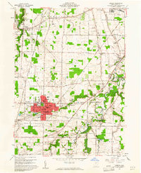
1960 Map of Oberlin
USGS Topo · Published 1961About this map
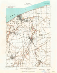
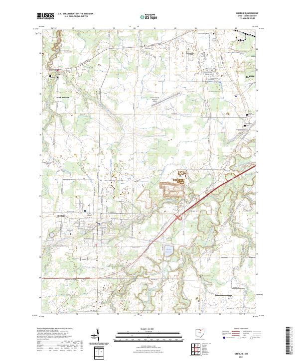
Oberlin College and its surrounding town center serve as the focal point of this 1960 survey, situated within the bounds of the Connecticut Western Reserve. The landscape is characterized by a transition from the academic and residential core of Oberlin to the industrial and agricultural outskirts, marked by prominent sandstone quarries near South Amherst. The map detail traces the intricate rail network of the era, featuring the New York Central and the N Y C & St L lines, which supported the region's movement of goods and people.
Find a feature on this map
61 named features on this map. Tap any name to fly to it.
Don’t see what you’re looking for? This feature index may not catch every label — zoom into the map to look around manually.
Map Details
Editions of this 1960 Oberlin Map
This is the sole edition of this map. No revisions or reprints were ever made.
Historical Maps of Elyria Through Time
9 maps found