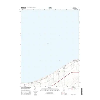
2016 Map of Vermilion West
USGS Topo · Published 2016About this map
The south shore of Lake Erie defines this 2016 survey, revealing a landscape shaped by lakefront leisure and small-town expansion. A dense string of shoreline communities, including Bluebird Beach, Orchard Beach, and Volunteer Bay, marks the edge where the land meets the water. In the eastern portion of the sheet, the town of Vermilion serves as a primary hub, its residential streets stretching toward the lake while Sherod Creek and Chappel Creek provide natural drainage from the inland farm plots. Genealogical interest is anchored by the Cuddleback Cemetery, located just off W Lake Road. The survey illustrates the modern road network, from the lakeside corridors of Cleveland Road E to the rural sections of Kneisel Road, showing how contemporary residential development has integrated with the area's agricultural past.
Find a feature on this map
33 named features on this map. Tap any name to fly to it.
Don’t see what you’re looking for? This feature index may not catch every label — zoom into the map to look around manually.
Map Details
Editions of this 2016 Vermilion West Map
This is the sole edition of this map. No revisions or reprints were ever made.
Other maps of this area

1903 · Vermilion
USGS Topo · 1:62,500

1904 · Sandusky
USGS Topo · 1:62,500

1916 · Kelleys Island
USGS Topo · 1:62,500

1919 · Kelleys Island
USGS Topo · 1:62,500

1956 · Toledo
USGS Topo · 1:250,000

1959 · Milan
USGS Topo · 1:24,000

1959 · Berlin Heights
USGS Topo · 1:24,000

1959 · Vermilion East
USGS Topo · 1:24,000

1959 · Vermilion West
USGS Topo · 1:24,000

1959 · Kipton
USGS Topo · 1:24,000