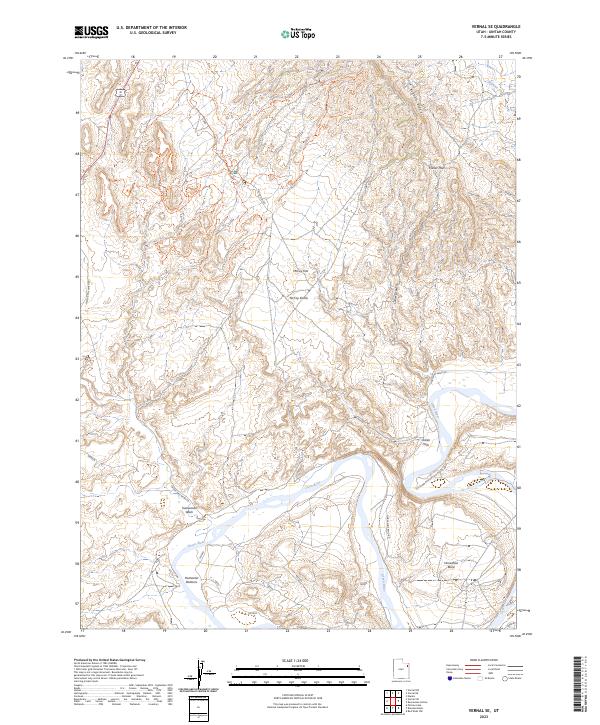
2023 Map of Vernal SE
USGS Topo · Published 2023About this map
The Green River carves a dramatic path through this Uintah County landscape, defining the topography south of Vernal. Significant alluvial features such as Hamacker Bottoms and the pronounced curve of Horseshoe Bend illustrate the river's historical influence on the terrain. To the north, Asphalt Ridge and Collier Pass mark the higher elevations, while McCoy Flat and the McCoy Knolls represent the arid basin character of the region.
Find a feature on this map
22 named features on this map. Tap any name to fly to it.
Don’t see what you’re looking for? This feature index may not catch every label — zoom into the map to look around manually.
Map Details
Editions of this 2023 Vernal SE Map
This is the sole edition of this map. No revisions or reprints were ever made.
Other maps of this area

1885 · Ashley
USGS Topo · 1:250,000

1907 · Jensen
USGS Topo · 1:125,000

1910 · Jensen
USGS Topo · 1:125,000

1917 · Vernal
USGS Topo · 1:125,000

1954 · Vernal
USGS Topo · 1:250,000

1958 · Vernal
USGS Topo · 1:250,000

1960 · Vernal
USGS Topo · 1:250,000

1964 · Vernal NE
USGS Topo · 1:24,000

1964 · Brennan Basin
USGS Topo · 1:24,000
1964 · Vernal SW
USGS Topo · 1:24,000