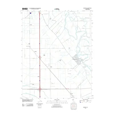
2012 Map of Vernalis
USGS Topo · Published 2012About this map
The San Joaquin River carves a winding path through this San Joaquin Valley landscape, defining a region where complex water management systems and agriculture intersect. The area is marked by a massive infrastructure network including the Governor Edmund G Brown California Aqueduct, the Delta-Mendota Canal, and the Hetch Hetchy Aqueduct, which cut across the terrain alongside numerous irrigation channels like the Banta Carbona Canal and East Branch Lateral. Small settlements and clusters like Vernalis, San Joaquin City, and Cochrane are interspersed among large-scale energy and transport features.
Find a feature on this map
68 named features on this map. Tap any name to fly to it.
Don’t see what you’re looking for? This feature index may not catch every label — zoom into the map to look around manually.
Map Details
Editions of this 2012 Vernalis Map
This is the sole edition of this map. No revisions or reprints were ever made.
Other maps of this area

1913 · Romain
USGS Topo · 1:31,680

1914 · Manteca
USGS Topo · 1:31,680

1914 · Union Island
USGS Topo · 1:31,680

1915 · Vernalis
USGS Topo · 1:31,680

1915 · Lathrop
USGS Topo · 1:31,680

1915 · Ripon
USGS Topo · 1:31,680

1915 · Westley
USGS Topo · 1:31,680

1916 · Tracy
USGS Topo · 1:31,680

1916 · Romain
USGS Topo · 1:31,680

1922 · Carbona
USGS Topo · 1:62,500