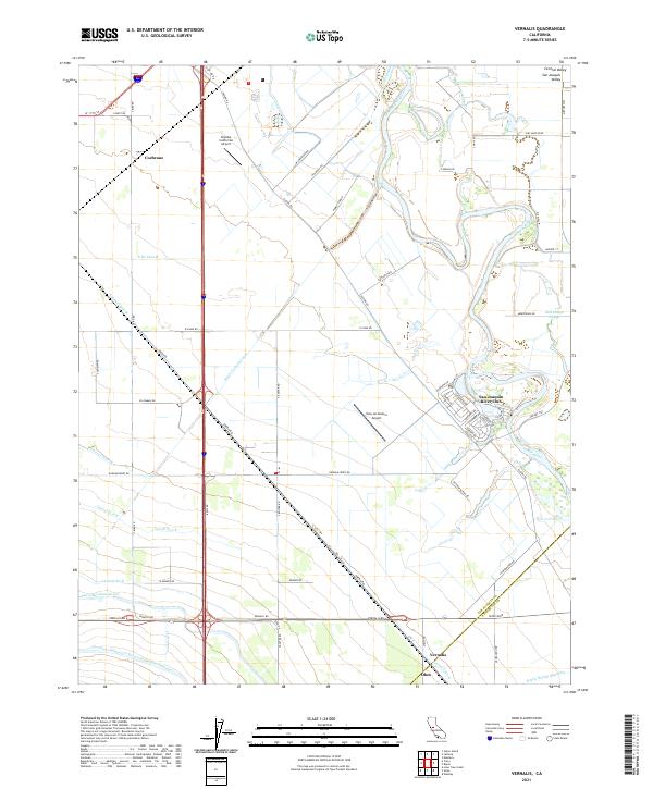
2021 Map of Vernalis
USGS Topo · Published 2021About this map
The San Joaquin River meanders through this agricultural section of the San Joaquin Valley, defining the border between San Joaquin and Stanislaus counties. The landscape is a complex network of water management, featuring massive infrastructure such as the Governor Edmund G. Brown California Aqueduct, the Delta-Mendota Canal, and the Hetch Hetchy Aqueduct. These engineering works, along with the Banta Carbona Canal and numerous laterals like Lateral Five W, illustrate the intensive irrigation required to support the local economy. Small settlements and industrial points like Vernalis, Cochrane, and Ohm are situated along the transit corridors that crisscross the valley floor.
Find a feature on this map
70 named features on this map. Tap any name to fly to it.
Don’t see what you’re looking for? This feature index may not catch every label — zoom into the map to look around manually.
Map Details
Editions of this 2021 Vernalis Map
This is the sole edition of this map. No revisions or reprints were ever made.
Other maps of this area

1913 · Romain
USGS Topo · 1:31,680

1914 · Manteca
USGS Topo · 1:31,680

1914 · Union Island
USGS Topo · 1:31,680

1915 · Vernalis
USGS Topo · 1:31,680

1915 · Lathrop
USGS Topo · 1:31,680

1915 · Ripon
USGS Topo · 1:31,680

1915 · Westley
USGS Topo · 1:31,680

1916 · Tracy
USGS Topo · 1:31,680

1916 · Romain
USGS Topo · 1:31,680

1922 · Carbona
USGS Topo · 1:62,500