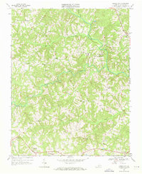
1968 Map of Vernon Hill
USGS Topo · Published 1971About this map
Banister River winds through this rural portion of Halifax County, serving as a primary geographic anchor for numerous small communities and family landmarks in the late 1960s. The landscape is dotted with centers of local life, including Vernon Hill and Meadville, where the presence of the Meadville Sch and several churches like New Zion Ch reflect the social fabric of the era. To the north and west, settlements such as Elkhorn and Rodden are situated among a network of smaller waterways, including Bye Creek and Bradley Creek.
Find a feature on this map
32 named features on this map. Tap any name to fly to it.
Don’t see what you’re looking for? This feature index may not catch every label — zoom into the map to look around manually.
Map Details
Editions of this 1968 Vernon Hill Map
Other maps of this area

1952 · Milton
USGS Topo · 1:62,500

1953 · South Boston
USGS Topo · 1:62,500

1953 · Greensboro
USGS Topo · 1:250,000

1954 · Greensboro
USGS Topo · 1:250,000

1954 · Halifax
USGS Topo · 1:62,500

1954 · Riceville
USGS Topo · 1:62,500

1956 · Milton
USGS Topo · 1:62,500

1957 · South Boston
USGS Topo · 1:62,500

1962 · Greensboro
USGS Topo · 1:250,000

1966 · Greensboro
USGS Topo · 1:250,000