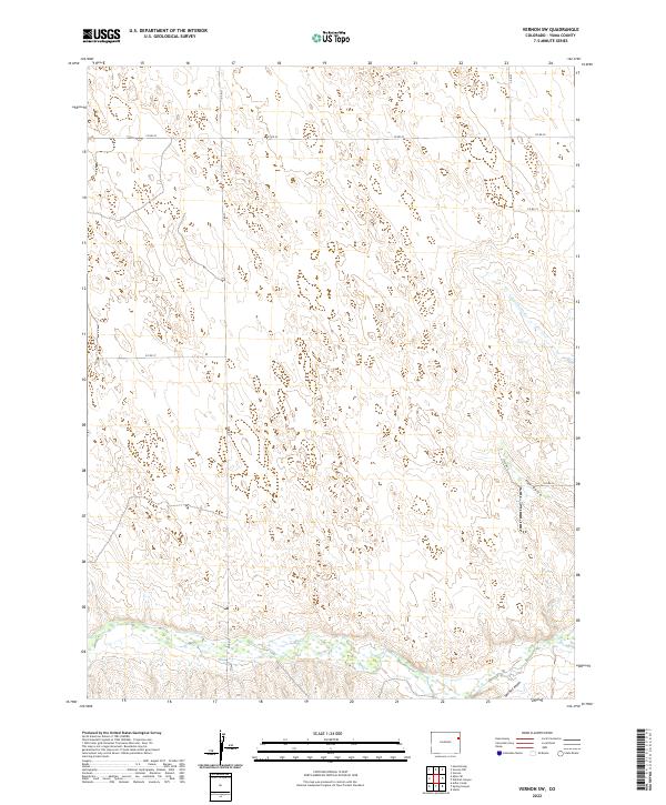
2022 Map of Vernon SW
USGS Topo · Published 2022About this map
The Arikaree River corridor defines the southern reaches of this Yuma County landscape, where the seasonal waterway carves through the High Plains. This area is characterized by its organized grid of section lines and gravel routes, including Co Rd U and Co Rd 20, which facilitate movement through the agricultural and grazing lands of eastern Colorado. The terrain is marked by subtle drainage features such as Copperkettle Cr and Hay Gulch, which illustrate the natural watershed patterns typical of the region's semi-arid environment. In the southernmost section, Spring Canyon descends toward the river, showing how local topography has been shaped by wind and water over time. The absence of concentrated town sites highlights the quiet, rural character of this township and range territory.
Find a feature on this map
14 named features on this map. Tap any name to fly to it.
Don’t see what you’re looking for? This feature index may not catch every label — zoom into the map to look around manually.
Map Details
Editions of this 2022 Vernon SW Map
This is the sole edition of this map. No revisions or reprints were ever made.
Other maps of this area

1954 · Limon
USGS Topo · 1:250,000

1957 · Limon
USGS Topo · 1:250,000

1958 · Limon
USGS Topo · 1:250,000

1963 · Vernon
USGS Topo · 1:24,000

1963 · Wildcat Canyon
USGS Topo · 1:24,000

1968 · Abarr SE
USGS Topo · 1:24,000

1968 · Vernon SW
USGS Topo · 1:24,000

1968 · Spring Canyon
USGS Topo · 1:24,000

1968 · Adler Creek
USGS Topo · 1:24,000

1968 · Idalia
USGS Topo · 1:24,000