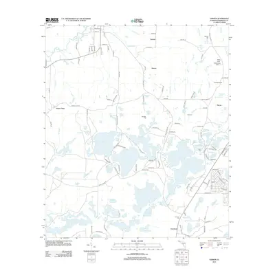
2012 Map of Vernon
USGS Topo · Published 2012About this map
Holmes Creek and its many interconnected tributaries and ponds dominate this portion of Washington County. The settlement patterns reflect a landscape deeply intertwined with its hydrology, where small communities like Sylvania, Smyrna, and Greenhead are situated on the higher ground surrounding an intricate network of wetlands. To the west, the residential development near Holmes Valley contrasts with the dense clusters of named water bodies to the southeast, including Pine Log Lake and Payne Lake.
Find a feature on this map
160 named features on this map. Tap any name to fly to it.
Don’t see what you’re looking for? This feature index may not catch every label — zoom into the map to look around manually.
Map Details
Editions of this 2012 Vernon Map
This is the sole edition of this map. No revisions or reprints were ever made.
Other maps of this area

1944 · Crystal Lake
USGS Topo · 1:24,000

1944 · Bennett
USGS Topo · 1:24,000

1945 · Bennett
USGS Topo · 1:31,680

1945 · Red Head
USGS Topo · 1:31,680

1945 · Crystal Lake
USGS Topo · 1:31,680

1949 · Millers Ferry
USGS Topo · 1:24,000

1949 · Hinsons Cross Roads
USGS Topo · 1:24,000

1950 · Millers Ferry
USGS Topo · 1:24,000

1950 · Hinsons Cross Roads
USGS Topo · 1:24,000

1950 · Vernon
USGS Topo · 1:24,000