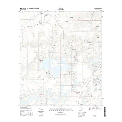
2015 Map of Vernon
USGS Topo · Published 2015About this map
Vernon serves as a central hub in this part of Washington County, situated where Pippin Mill Cr flows into Holmes Creek. The landscape is defined by an intricate network of karst topography, appearing as a dense concentration of solution lakes and ponds such as Dunford Lake, Hicks Lake, and Lucas Lake. These water bodies, along with smaller features like Baptizing Pond and Double Ponds, dictate the local road patterns and land use. Small settlements and named locales including Sylvania, Smyrna, and Holmes Valley are scattered across the terrain, connected by rural routes like Sylvania Rd and Moss Hill Rd. The map provides significant detail for genealogists, recording the locations of Potter Cem, Tiller Cem, and Greenhead Cem. To the east, the terrain rises toward Weaver Hill and Rattlesnake Head, showing the transition from the lake-studded lowlands to more elevated ground near Macom.
Find a feature on this map
129 named features on this map. Tap any name to fly to it.
Don’t see what you’re looking for? This feature index may not catch every label — zoom into the map to look around manually.
Map Details
Editions of this 2015 Vernon Map
This is the sole edition of this map. No revisions or reprints were ever made.
Other maps of this area

1944 · Crystal Lake
USGS Topo · 1:24,000

1944 · Bennett
USGS Topo · 1:24,000

1945 · Bennett
USGS Topo · 1:31,680

1945 · Red Head
USGS Topo · 1:31,680

1945 · Crystal Lake
USGS Topo · 1:31,680

1949 · Millers Ferry
USGS Topo · 1:24,000

1949 · Hinsons Cross Roads
USGS Topo · 1:24,000

1950 · Millers Ferry
USGS Topo · 1:24,000

1950 · Hinsons Cross Roads
USGS Topo · 1:24,000

1950 · Vernon
USGS Topo · 1:24,000