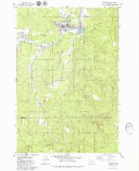
1979 Map of Vernonia
USGS Topo · Published 1980About this map
Vernonia sits at the confluence of the Nehalem River and Rock Creek, serving as a central hub in this timber-rich region of Columbia County. The landscape is defined by the steep timberlands of the Tillamook State Forest, which covers the southern portion of the sheet near the Washington County line. Local landmarks like the Vernonia Grange and the Corey Hill Sch reflect the community's agricultural and social foundations, while the Pioneer Cem offers a direct link to early settlement history. Moving south along the river, smaller localities like Treharne and Braun appear as minor junctions in the valley. The map documents an era of established recreational and municipal infrastructure, from the Vernonia Golf Course and Hawkins Park to the Sewage Disposal Ponds and the reclaimed waters of Vernonia Lake.
Find a feature on this map
46 named features on this map. Tap any name to fly to it.
Don’t see what you’re looking for? This feature index may not catch every label — zoom into the map to look around manually.
Map Details
Editions of this 1979 Vernonia Map
2 editions found
Other maps of this area

1940 · Vernonia
USGS Topo · 1:62,500

1941 · Keasey
USGS Topo · 1:62,500

1941 · Timber
USGS Topo · 1:62,500

1941 · Gales Creek
USGS Topo · 1:62,500

1943 · Vernonia
USGS Topo · 1:62,500

1943 · Keasey
USGS Topo · 1:62,500

1948 · Vancouver
USGS Topo · 1:250,000

1950 · Vancouver
USGS Topo · 1:250,000

1950 · Vancouver
USGS Topo · 1:250,000

1955 · Timber
USGS Topo · 1:62,500