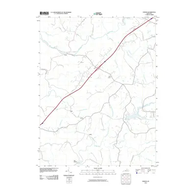
2010 Map of Verona
USGS Topo · Published 2010About this map
Zion Station and the rural crossroads of Munk anchor this northern Kentucky landscape, where the headwaters of numerous creeks carve through the terrain. The drainage network is dense, featuring the winding paths of Ten Mile Creek and its tributary, North Fork Ten Mile Creek, alongside the northern flows of Mud Lick Creek and McCoys Fork. These waterways historically dictated the placement of early settlements and family properties, many of which are still identifiable through eponymous roads like McCoys Fork Rd and Stephenson Mill Rd.
Find a feature on this map
54 named features on this map. Tap any name to fly to it.
Don’t see what you’re looking for? This feature index may not catch every label — zoom into the map to look around manually.
Map Details
Editions of this 2010 Verona Map
This is the sole edition of this map. No revisions or reprints were ever made.
Other maps of this area

1943 · Rising Sun
USGS Topo · 1:24,000

1943 · Patriot
USGS Topo · 1:24,000

1950 · Glencoe
USGS Topo · 1:24,000

1950 · Elliston
USGS Topo · 1:24,000

1950 · Union
USGS Topo · 1:24,000

1950 · Williamstown
USGS Topo · 1:24,000

1950 · Independence
USGS Topo · 1:24,000

1950 · Verona
USGS Topo · 1:24,000

1950 · Walton
USGS Topo · 1:24,000

1951 · Rising Sun
USGS Topo · 1:24,000