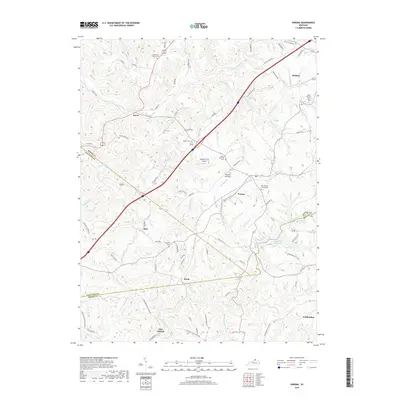
2019 Map of Verona
USGS Topo · Published 2019About this map
Verona serves as a central hub in this Northern Kentucky landscape where the borders of Boone, Gallatin, and Grant counties converge. The terrain is defined by a dense network of creek valleys and ridges, with Ten Mile Creek and Mud Lick Creek carving through the countryside. This modern survey illustrates how long-established rural settlements like Zion Station, Ryle, and Munk maintain their identity alongside modern infrastructure. Genealogists will find a significant distribution of family and community burial grounds, including the New Bethel Church Cem, Carr Cem, and Saints Patricks Cem near the Verona Landing. The eastern edge of the map shows the growth of Walton and the recreational waters of Bullock Pen Lake, while the Mueller Farm Airport represents the local aviation history of the region.
Find a feature on this map
81 named features on this map. Tap any name to fly to it.
Don’t see what you’re looking for? This feature index may not catch every label — zoom into the map to look around manually.
Map Details
Editions of this 2019 Verona Map
This is the sole edition of this map. No revisions or reprints were ever made.
Other maps of this area

1943 · Rising Sun
USGS Topo · 1:24,000

1943 · Patriot
USGS Topo · 1:24,000

1950 · Glencoe
USGS Topo · 1:24,000

1950 · Elliston
USGS Topo · 1:24,000

1950 · Union
USGS Topo · 1:24,000

1950 · Williamstown
USGS Topo · 1:24,000

1950 · Independence
USGS Topo · 1:24,000

1950 · Verona
USGS Topo · 1:24,000

1950 · Walton
USGS Topo · 1:24,000

1951 · Rising Sun
USGS Topo · 1:24,000