2022 Map of Verona
USGS Topo · Published 2022About this map
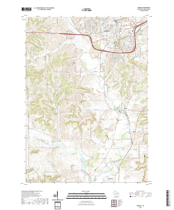
Sugar River and its various tributaries define the rural landscape of this Dane County region, where agricultural fields meet the growing residential outskirts of Verona. The drainage pattern is complex, featuring the West Branch Sugar River, Badger Mill Cr, and Mount Vernon Cr, which carve through the undulating terrain near Badger Mill Hill and Mt Julia. Smaller settlements like Paoli, Basco, and Montrose anchor the southern half of the map, maintaining their distinct character amidst the surrounding farmland.
Find a feature on this map
132 named features on this map. Tap any name to fly to it.
Don’t see what you’re looking for? This feature index may not catch every label — zoom into the map to look around manually.
Map Details
Editions of this 2022 Verona Map
This is the sole edition of this map. No revisions or reprints were ever made.