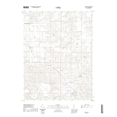
2021 Map of Versailles
USGS Topo · Published 2021About this map
Versailles and Mount Sterling anchor this portion of Brown County, where the agricultural landscape is divided by the meandering courses of McKee Creek and Logan Cr. The terrain is notably marked by family-named landmarks and a high density of small cemeteries, suggesting a deep-rooted genealogical history. Features such as the Benjamin Robinson Burial Ground and Ichabod Perry Cem point to early pioneer legacies, while named ridges like Wheeler Ridge and water features like Versailles Springs define the local topography. This survey shows a transition between the organized grid of county roads, such as Co RD 750 N, and the more irregular paths dictated by the drainage basins of Camp Cr and Avery Br. The map also details smaller locales such as Hersman, Gilbirds, and Jaques, providing a comprehensive view of the rural settlement patterns near the Hambaugh-Martin Number Five Reservoir.
Find a feature on this map
86 named features on this map. Tap any name to fly to it.
Don’t see what you’re looking for? This feature index may not catch every label — zoom into the map to look around manually.
Map Details
Editions of this 2021 Versailles Map
This is the sole edition of this map. No revisions or reprints were ever made.
Other maps of this area

1923 · Rushville
USGS Topo · 1:62,500

1926 · Rushville
USGS Topo · 1:62,500

1926 · Mt Sterling
USGS Topo · 1:62,500

1928 · Meredosia
USGS Topo · 1:62,500

1929 · Mt Sterling
USGS Topo · 1:62,500

1931 · Meredosia
USGS Topo · 1:62,500

1946 · Augusta
USGS Topo · 1:62,500

1948 · Quincy
USGS Topo · 1:250,000

1949 · Augusta
USGS Topo · 1:62,500

1956 · Quincy
USGS Topo · 1:250,000