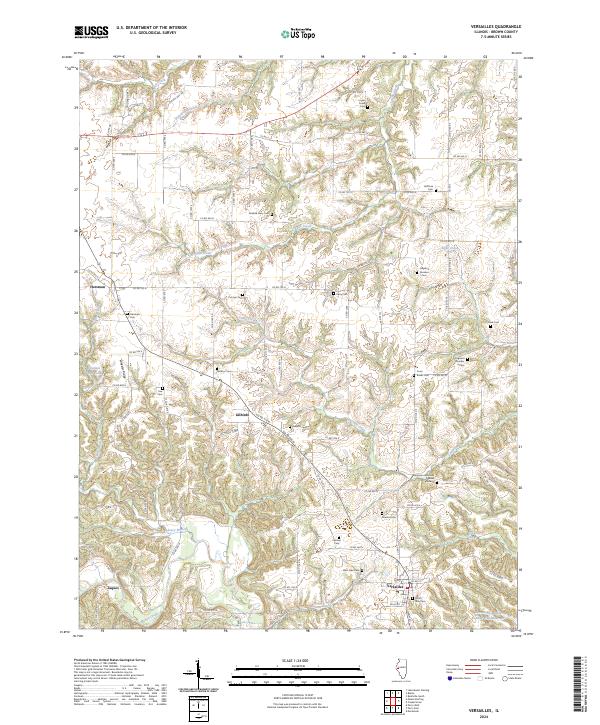
2024 Map of Versailles
USGS Topo · Published 2024About this map
Versailles serves as the primary hub of this Brown County landscape, situated atop a plateau where the terrain begins to break toward the McKee Creek valley to the south. The area is defined by a dense concentration of small, family-named burial sites, suggesting a deeply rooted agricultural history and ancestral landholdings. Notable among these are the Benjamin Robinson Burial Ground, the Ichabod Perry Cem, and the dual Logsdon Number 1 and Logsdon Number 2 cemeteries. The topography is marked by the prominent Wheeler Ridge, which overlooks the winding Camp Creek as it carves through the local township lines. Smaller settlements like Hersman and Gilbirds anchor the northern and central sections, while the presence of the Hambaugh-Martin Number Five Reservoir and Kleinlein Farm Pond reflect the importance of local water management in this rural Illinois community.
Find a feature on this map
89 named features on this map. Tap any name to fly to it.
Don’t see what you’re looking for? This feature index may not catch every label — zoom into the map to look around manually.
Map Details
Editions of this 2024 Versailles Map
This is the sole edition of this map. No revisions or reprints were ever made.
Other maps of this area

1923 · Rushville
USGS Topo · 1:62,500

1926 · Rushville
USGS Topo · 1:62,500

1926 · Mt Sterling
USGS Topo · 1:62,500

1928 · Meredosia
USGS Topo · 1:62,500

1929 · Mt Sterling
USGS Topo · 1:62,500

1931 · Meredosia
USGS Topo · 1:62,500

1946 · Augusta
USGS Topo · 1:62,500

1948 · Quincy
USGS Topo · 1:250,000

1949 · Augusta
USGS Topo · 1:62,500

1956 · Quincy
USGS Topo · 1:250,000