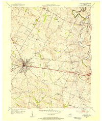
1954 Map of Versailles
USGS Topo · Published 1955About this map
Versailles serves as the hub of this 1954 topographic study, situated at the crossing of the Midland Trail and the Southern Railway. The map captures a transition in Woodford County’s economy, where traditional tobacco-growing landscapes meet industrial features like the Phosphate Strip Mine near Wallace. Significant local institutions are documented in detail, including the Simmons High Sch, a local Orphanage, and the County Infirmary south of town.
Find a feature on this map
51 named features on this map. Tap any name to fly to it.
Don’t see what you’re looking for? This feature index may not catch every label — zoom into the map to look around manually.
Map Details
Editions of this 1954 Versailles Map
This is the sole edition of this map. No revisions or reprints were ever made.
Other maps of this area

1905 · Harrodsburg
USGS Topo · 1:125,000

1906 · Georgetown
USGS Topo · 1:62,500

1908 · Georgetown
USGS Topo · 1:62,500

1922 · Frankfort
USGS Topo · 1:48,000

1924 · Frankfort
USGS Topo · 1:62,500

1950 · Lexington West
USGS Topo · 1:24,000

1952 · Keene
USGS Topo · 1:24,000

1952 · Nicholasville
USGS Topo · 1:24,000

1952 · Salvisa
USGS Topo · 1:24,000

1952 · Midway
USGS Topo · 1:24,000