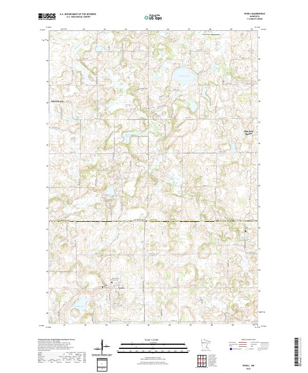
2022 Map of Veseli
USGS Topo · Published 2022About this map
Veseli and Saint Patrick anchor this survey of the glacial landscape along the border of Scott and Rice Counties. The terrain is defined by a dense network of kettle lakes and wetlands, including Lennon Lake, Bradshaw Lake, and Nash Lake, which feed the wandering path of Porter Cr. The settlement pattern reflects the area's agricultural roots and religious heritage, centered on local landmarks like Pioneers Holy Trinity Cem and Saint Johns Cem. While contemporary roads such as New Prague Blvd and Co Hwy 6 provide modern connectivity, the underlying Public Land Survey System grid still dictates the placement of rural farmsteads and field boundaries. To the northeast, the expanding footprint of Elko New Market shows the transition from quiet township lands to growing suburban centers, even as Smith Field remains a distinct marker of local aviation history.
Find a feature on this map
46 named features on this map. Tap any name to fly to it.
Don’t see what you’re looking for? This feature index may not catch every label — zoom into the map to look around manually.
Map Details
Editions of this 2022 Veseli Map
This is the sole edition of this map. No revisions or reprints were ever made.
Other maps of this area

1953 · Saint Paul
USGS Topo · 1:250,000

1957 · Prior Lake
USGS Topo · 1:62,500

1957 · New Prague
USGS Topo · 1:62,500

1959 · Saint Paul
USGS Topo · 1:250,000

1960 · Lonsdale
USGS Topo · 1:24,000

1960 · Little Chicago
USGS Topo · 1:24,000

1966 · Montgomery
USGS Topo · 1:24,000
1974 · Prior Lake
USGS Topo · 1:24,000
1974 · New Market
USGS Topo · 1:24,000
1974 · Veseli
USGS Topo · 1:24,000