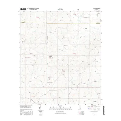
2015 Map of Vestry
USGS Topo · Published 2015About this map
Vestry and Dantzler sit at the center of this 2015 study of the Mississippi piney woods, where the landscape is defined by the winding paths of Red Creek and its many tributaries. Much of the western and central territory is protected within the Desoto National Forest, a terrain of creek bottoms and timberland cut through by historical routes like Wire Rd and Old Biloxi Rd. This modern survey provides a clear view of local genealogy through numerous family-named landmarks and resting places, including the Carter Cem, Wilson Cem, and Byrd Cem. To the north, Flurry Mill Pond Br hints at the historical water-driven industry that once shaped these rural communities. The map captures the meeting of George and Jackson Counties, tracing the hydrological network from Little Red Cr down to the southern flow of Wolf Br and Bluff Cr.
Find a feature on this map
76 named features on this map. Tap any name to fly to it.
Don’t see what you’re looking for? This feature index may not catch every label — zoom into the map to look around manually.
Map Details
Editions of this 2015 Vestry Map
This is the sole edition of this map. No revisions or reprints were ever made.
Other maps of this area

1941 · Vancleave
USGS Topo · 1:62,500

1941 · Lucedale
USGS Topo · 1:62,500

1943 · Lucedale
USGS Topo · 1:62,500

1943 · Vancleave
USGS Topo · 1:62,500

1944 · Vancleave
USGS Topo · 1:62,500

1947 · Benndale
USGS Topo · 1:62,500

1949 · Benndale
USGS Topo · 1:62,500

1953 · Mobile
USGS Topo · 1:250,000

1954 · Vestry
USGS Topo · 1:62,500

1957 · Mobile
USGS Topo · 1:250,000