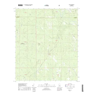
2018 Map of Vestry
USGS Topo · Published 2018About this map
De Soto National Forest covers much of this Jackson County landscape, where the rural settlements of Vestry and Dantzler sit among a dense network of coastal plain waterways. This area is defined by its drainages, including the prominent Red Creek and numerous branches like Hurry Mill Pond Br, Wolf Br, and Fivemile Br. The map reveals a high density of family-named burial sites, such as Flurry Cem, Ramsey Cem, Carter Cem, Wilson Cem, and Byrd Cem, which serve as vital markers for genealogical research in this part of Mississippi. Access to these remote timberlands and hunting grounds, including the Mill Creek Hunting Club, is provided by a grid of local routes like Wire Rd, Old Biloxi Rd, and Vestry Rd, illustrating the transition from historic logging trails to modern county roads.
Find a feature on this map
48 named features on this map. Tap any name to fly to it.
Don’t see what you’re looking for? This feature index may not catch every label — zoom into the map to look around manually.
Map Details
Editions of this 2018 Vestry Map
This is the sole edition of this map. No revisions or reprints were ever made.
Other maps of this area

1941 · Vancleave
USGS Topo · 1:62,500

1941 · Lucedale
USGS Topo · 1:62,500

1943 · Lucedale
USGS Topo · 1:62,500

1943 · Vancleave
USGS Topo · 1:62,500

1944 · Vancleave
USGS Topo · 1:62,500

1947 · Benndale
USGS Topo · 1:62,500

1949 · Benndale
USGS Topo · 1:62,500

1953 · Mobile
USGS Topo · 1:250,000

1954 · Vestry
USGS Topo · 1:62,500

1957 · Mobile
USGS Topo · 1:250,000