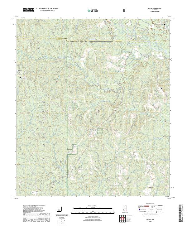
2024 Map of Vestry
USGS Topo · Published 2024About this map
De Soto National Forest covers much of this landscape along the border of George and Jackson counties, where the piney woods are dissected by numerous winding waterways. The settlement of Dantzler sits on the western edge, linked by the Larue-Dantzler Rd and Wire Rd, reflecting the rural infrastructure that has long supported local timber and agricultural interests. The hydrology of the region is defined by the systems of Red Creek, Little Red Creek, and Bluff Creek, with smaller tributaries like Indian Camp Branch and Flurry Mill Pond Branch feeding into the larger drainage basins.
Find a feature on this map
48 named features on this map. Tap any name to fly to it.
Don’t see what you’re looking for? This feature index may not catch every label — zoom into the map to look around manually.
Map Details
Editions of this 2024 Vestry Map
This is the sole edition of this map. No revisions or reprints were ever made.
Other maps of this area

1941 · Vancleave
USGS Topo · 1:62,500

1941 · Lucedale
USGS Topo · 1:62,500

1943 · Lucedale
USGS Topo · 1:62,500

1943 · Vancleave
USGS Topo · 1:62,500

1944 · Vancleave
USGS Topo · 1:62,500

1947 · Benndale
USGS Topo · 1:62,500

1949 · Benndale
USGS Topo · 1:62,500

1953 · Mobile
USGS Topo · 1:250,000

1954 · Vestry
USGS Topo · 1:62,500

1957 · Mobile
USGS Topo · 1:250,000