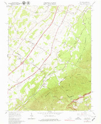
1965 Map of Vesuvius
USGS Topo · Published 1979About this map
Vesuvius and Steeles Tavern serve as primary points of orientation in this mid-1960s landscape, where the Shenandoah Valley meets the steep rise of the Blue Ridge. The Norfolk and Western railway corridor dictates the settlement pattern, connecting the small communities of Lofton, Spottswood, and Raphine. This survey captures the rural infrastructure of Augusta and Rockbridge Counties, including numerous local landmarks such as Old Providence Ch, Mt Carmel Ch, and the Spottswood Sch.
Find a feature on this map
49 named features on this map. Tap any name to fly to it.
Don’t see what you’re looking for? This feature index may not catch every label — zoom into the map to look around manually.
Map Details
Editions of this 1965 Vesuvius Map
Other maps of this area

1894 · Staunton
USGS Topo · 1:125,000

1894 · Lexington
USGS Topo · 1:125,000

1932 · Lexington
USGS Topo · 1:48,000

1936 · Vesuvius
USGS Topo · 1:48,000

1937 · Lexington
USGS Topo · 1:62,500

1941 · Vesuvius
USGS Topo · 1:62,500

1943 · Craigsville
USGS Topo · 1:62,500

1944 · Staunton
USGS Topo · 1:62,500

1945 · Craigsville
USGS Topo · 1:62,500

1947 · Staunton
USGS Topo · 1:62,500