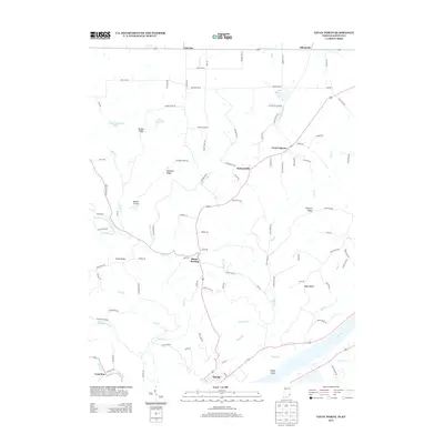
2013 Map of Vevay North
USGS Topo · Published 2013About this map
Vevay stands at the southern edge of this map, overlooking the Ohio River and Vevay Island in a landscape defined by the sharp transition from the river valley to the uplands of Switzerland County. The interior is characterized by a network of ridges and winding waterways, including Indian Cr and Plum Cr, which separate high-ground settlements like Mount Sterling, Jacksonville, and Center Square. This 2013 survey illustrates how modern infrastructure follows long-established transit corridors, with routes like Bennington Pike and Smith Ridge Rd navigating the complex terrain. Numerous small lakes and reservoirs, such as Lake Geneva and Edwin Pray Lake, are scattered across the northern reaches near Allensville. The presence of Roberts Airport and various family-named ridges like Drakes Ridge and Popcorn Ridge provide points of interest for those tracking the intersection of 21st-century landmarks and traditional rural settlement patterns.
Find a feature on this map
106 named features on this map. Tap any name to fly to it.
Don’t see what you’re looking for? This feature index may not catch every label — zoom into the map to look around manually.
Map Details
Editions of this 2013 Vevay North Map
This is the sole edition of this map. No revisions or reprints were ever made.
Other maps of this area

1943 · Florence
USGS Topo · 1:24,000

1943 · Aberdeen
USGS Topo · 1:24,000

1943 · Vevay North
USGS Topo · 1:24,000

1943 · Brooksburg
USGS Topo · 1:24,000

1943 · Vevay South
USGS Topo · 1:24,000

1951 · Florence
USGS Topo · 1:24,000

1951 · Sanders
USGS Topo · 1:24,000

1952 · Vevay South
USGS Topo · 1:24,000

1953 · Carrollton
USGS Topo · 1:24,000

1953 · Aberdeen
USGS Topo · 1:24,000