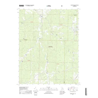
2017 Map of Viburnum West
USGS Topo · Published 2017About this map
Mark Twain National Forest dominates much of this landscape, where the rugged topography of the Ozarks is carved by the complex drainage of Huzzah Creek and its various tributaries. The settlement of Viburnum serves as a local hub near the eastern border, accompanied by the Viburnum Airport and Viburnum City Park Lake. Throughout the region, small communities like Dillard and Boss are connected by a network of local roads such as Dillard Mill Rd and State Hwy AC. The map reveals a high density of named family and local burial sites, including Dillard Cem, Maple Grove Cem, Fiebelman Cem, Hedrick Cem, and Richards Cem, providing valuable data for genealogical research. The terrain is characterized by numerous hollows, such as Beefsteak Hollow, Tinker Hollow, and Bills Hollow, which define the natural settlement patterns and timber-rich environment of Iron, Crawford, and Dent counties.
Find a feature on this map
66 named features on this map. Tap any name to fly to it.
Don’t see what you’re looking for? This feature index may not catch every label — zoom into the map to look around manually.
Map Details
Editions of this 2017 Viburnum West Map
This is the sole edition of this map. No revisions or reprints were ever made.
Other maps of this area

1932 · Steelville
USGS Topo · 1:48,000

1933 · Steelville
USGS Topo · 1:62,500

1937 · Steelville
USGS Topo · 1:62,500

1941 · Stone Hill
USGS Topo · 1:62,500

1943 · Berryman
USGS Topo · 1:62,500

1943 · Boss
USGS Topo · 1:62,500

1945 · Stone Hill
USGS Topo · 1:62,500

1945 · Berryman
USGS Topo · 1:62,500

1946 · Boss
USGS Topo · 1:62,500

1949 · Rolla
USGS Topo · 1:250,000