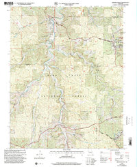
1999 Map of Viburnum West
USGS Topo · Published 2002About this map
Dillard Mill State Historical Site stands at the confluence of Huzzah Creek and James Branch, anchoring the northwestern corner of this landscape within the Mark Twain National Forest. The map documents a transition from the preserved historical industry at Dillard to the modern mineral processing facilities near Viburnum, where a Lead Recycling Center and a massive Tailings Pond signal the area's ongoing mining legacy. The terrain is deeply incised by numerous hollows, including Beefsteak Hollow and Tinker Hollow, which dictate the winding paths of rural routes through Crawford and Dent counties.
Find a feature on this map
42 named features on this map. Tap any name to fly to it.
Don’t see what you’re looking for? This feature index may not catch every label — zoom into the map to look around manually.
Map Details
Editions of this 1999 Viburnum West Map
This is the sole edition of this map. No revisions or reprints were ever made.
Other maps of this area

1932 · Steelville
USGS Topo · 1:48,000

1933 · Steelville
USGS Topo · 1:62,500

1937 · Steelville
USGS Topo · 1:62,500

1941 · Stone Hill
USGS Topo · 1:62,500

1943 · Berryman
USGS Topo · 1:62,500

1943 · Boss
USGS Topo · 1:62,500

1945 · Stone Hill
USGS Topo · 1:62,500

1945 · Berryman
USGS Topo · 1:62,500

1946 · Boss
USGS Topo · 1:62,500

1949 · Rolla
USGS Topo · 1:250,000