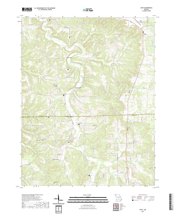
2021 Map of Vichy
USGS Topo · Published 2021About this map
Rolla National Airport anchors the northeast corner of this 2021 study, situated near the settlement of Vichy at the junction of Co RD 539 and Co RD 528. The landscape is a complex of ridges and hollows defined by the drainage of Spring Cr, Mill Cr, and Miller Br. The density of family burial grounds across this portion of the Ozarks is striking, suggesting a long history of generational land ownership. Locations such as Tennison Cem, Spencer Cem, and the Hazzard Farm Burials are preserved alongside larger topographic landmarks like Pilot Knob and Weaver Ridge. The boundary between Maries and Phelps counties bisects the map, running near Davis Ford and Bloom Hollow, where the road network transitions from state highways to remote county routes.
Find a feature on this map
88 named features on this map. Tap any name to fly to it.
Don’t see what you’re looking for? This feature index may not catch every label — zoom into the map to look around manually.
Map Details
Editions of this 2021 Vichy Map
This is the sole edition of this map. No revisions or reprints were ever made.
Other maps of this area

1912 · Rolla
USGS Topo · 1:62,500

1928 · Meramec Spring
USGS Topo · 1:62,500

1934 · Redbird
USGS Topo · 1:62,500

1937 · Vienna
USGS Topo · 1:62,500

1938 · Redbird
USGS Topo · 1:62,500

1938 · Vienna
USGS Topo · 1:48,000

1949 · Saint Louis
USGS Topo · 1:250,000

1949 · Vienna
USGS Topo · 1:62,500

1949 · Rolla
USGS Topo · 1:250,000

1949 · Meramec Spring
USGS Topo · 1:62,500