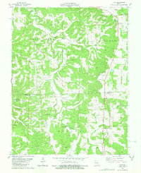
1980 Map of Vichy
USGS Topo · Published 1981About this map
The Vichy settlement and the adjacent Rolla National Airport define the northeastern corner of this Ozark plateau landscape, where the plateau begins its descent into a series of steep hollows and ridges. The map reveals a deeply etched topography characterized by features like East Coyle Hollow and Gaines Ridge, with numerous springs and small waterways such as Weaver Creek and Rocky Branch cutting through the terrain. Evidence of the region's extractive economy is visible through several Claypit and Quarry sites near the settlement of Macedonia.
Find a feature on this map
50 named features on this map. Tap any name to fly to it.
Don’t see what you’re looking for? This feature index may not catch every label — zoom into the map to look around manually.
Map Details
Editions of this 1980 Vichy Map
This is the sole edition of this map. No revisions or reprints were ever made.
Other maps of this area

1912 · Rolla
USGS Topo · 1:62,500

1928 · Meramec Spring
USGS Topo · 1:62,500

1934 · Redbird
USGS Topo · 1:62,500

1937 · Vienna
USGS Topo · 1:62,500

1938 · Redbird
USGS Topo · 1:62,500

1938 · Vienna
USGS Topo · 1:48,000

1949 · Saint Louis
USGS Topo · 1:250,000

1949 · Vienna
USGS Topo · 1:62,500

1949 · Rolla
USGS Topo · 1:250,000

1949 · Meramec Spring
USGS Topo · 1:62,500