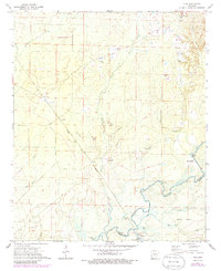
1971 Map of Vick
USGS Topo · Published 1986About this map
The Saline River defines the southern landscape of this 1970s Bradley County survey, meandering through a complex of wetlands and backwaters including Black Lake, Mud Lake, and Robinson Bay. The river's influence on the terrain is evident at Oxbow Bend and the large Norrel Island, while the presence of Bogalusa Camp and Stillions near the riverbanks suggests a history of river-based industry and seasonal habitation. This era shows the local infrastructure transitioning, with the Fordyce and Princeton corridor and a prominent Lookout Tower marking the wooded uplands.
Find a feature on this map
36 named features on this map. Tap any name to fly to it.
Don’t see what you’re looking for? This feature index may not catch every label — zoom into the map to look around manually.
Map Details
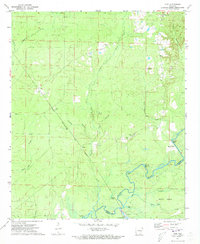
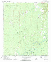
Editions of this 1971 Vick Map
3 editions found
Other maps of this area

1934 · Ingalls
USGS Topo · 1:48,000

1934 · Felsenthal
USGS Topo · 1:62,500

1937 · Felsenthal
USGS Topo · 1:62,500

1937 · Ingalls
USGS Topo · 1:62,500

1938 · Felsenthal
USGS Topo · 1:62,500

1939 · Felsenthal
USGS Topo · 1:62,500

1939 · Ingalls
USGS Topo · 1:62,500

1953 · Greenwood
USGS Topo · 1:250,000

1953 · El Dorado
USGS Topo · 1:250,000

1956 · Greenwood
USGS Topo · 1:250,000