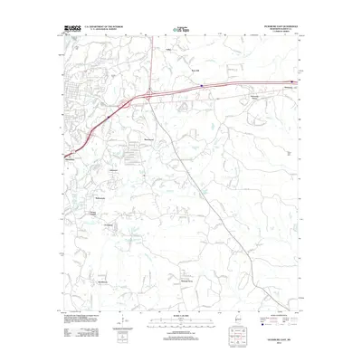
2012 Map of Vicksburg East
USGS Topo · Published 2012About this map
Vicksburg National Cem and the prominent height of Fort Hill overlook the northern reaches of this Mississippi landscape, marking a terrain defined by complex drainage and suburban expansion. The survey shows the growth of residential clusters like Bellemeade, Lakewood, and Beechwood as they fill the spaces between historic corridors. Moving east from the city core, the landscape transitions into more dispersed settlements such as Newmans Grove and Culkin, where the land is still carved by the winding paths of Cooks Bayou and Wren Bayou.
Find a feature on this map
214 named features on this map. Tap any name to fly to it.
Don’t see what you’re looking for? This feature index may not catch every label — zoom into the map to look around manually.
Map Details
Editions of this 2012 Vicksburg East Map
This is the sole edition of this map. No revisions or reprints were ever made.
Other maps of this area

1918 · Vicksburg
USGS Topo · 1:62,500

1938 · Edwards
USGS Topo · 1:62,500

1939 · Yokena
USGS Topo · 1:62,500

1941 · Vicksburg
USGS Topo · 1:62,500

1955 · Jackson
USGS Topo · 1:250,000

1961 · Jackson
USGS Topo · 1:250,000

1962 · Jackson
USGS Topo · 1:250,000

1962 · Redwood
USGS Topo · 1:24,000

1962 · Vicksburg West
USGS Topo · 1:24,000
1962 · Long Lake
USGS Topo · 1:24,000