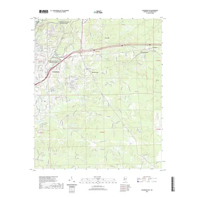
2020 Map of Vicksburg East
USGS Topo · Published 2020About this map
Vicksburg National Military Park dominates the northwest quadrant of this terrain, its boundaries weaving through the high ground of the Hills of the Valley. The landscape is defined by its deep loess bluffs and complex drainage systems, where Glass Bayou and Mint Spring Br cut toward the Mississippi River. This modern survey shows the expansion of Vicksburg eastward into communities like Beechwood and Newmans Grove, while maintaining the distinct footprint of historical sites such as Ft Hill and Anshe Chesed. Significant genealogical markers are found at Beulah Cem and Mount Albin Cem, while local institutions like Hinds Community College reflect the area's contemporary development. The map meticulously tracks the winding courses of Hatcher Bayou and Shiloh Cr as they navigate the ridges and valleys south of the city center.
Find a feature on this map
186 named features on this map. Tap any name to fly to it.
Don’t see what you’re looking for? This feature index may not catch every label — zoom into the map to look around manually.
Map Details
Editions of this 2020 Vicksburg East Map
This is the sole edition of this map. No revisions or reprints were ever made.
Other maps of this area

1918 · Vicksburg
USGS Topo · 1:62,500

1938 · Edwards
USGS Topo · 1:62,500

1939 · Yokena
USGS Topo · 1:62,500

1941 · Vicksburg
USGS Topo · 1:62,500

1955 · Jackson
USGS Topo · 1:250,000

1961 · Jackson
USGS Topo · 1:250,000

1962 · Jackson
USGS Topo · 1:250,000

1962 · Redwood
USGS Topo · 1:24,000

1962 · Vicksburg West
USGS Topo · 1:24,000
1962 · Long Lake
USGS Topo · 1:24,000