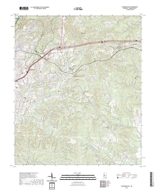
2024 Map of Vicksburg East
USGS Topo · Published 2024About this map
The eastern edges of Vicksburg and the sprawling Vicksburg National Military Park anchor this modern-day topographic survey of Warren County. The landscape is defined by a dense network of watercourses and bayous, including Hatcher Bayou, Glass Bayou, and Shiloh Creek, which carve through the varied elevation of Rose Hill. Cultural and family history is preserved in several burial grounds such as Beulah Cem, Anshe Chesed Cem, and the more remote Mount Albin Cem to the east. Modern expansion is visible in the campus of Hinds Community College and residential developments around Beechwood. The transit corridor of Interstate 20 bisects the terrain, passing through the settlements of Newmans Grove and Newmans as it moves away from the historical core of the city.
Find a feature on this map
188 named features on this map. Tap any name to fly to it.
Don’t see what you’re looking for? This feature index may not catch every label — zoom into the map to look around manually.
Map Details
Editions of this 2024 Vicksburg East Map
This is the sole edition of this map. No revisions or reprints were ever made.
Other maps of this area

1918 · Vicksburg
USGS Topo · 1:62,500

1938 · Edwards
USGS Topo · 1:62,500

1939 · Yokena
USGS Topo · 1:62,500

1941 · Vicksburg
USGS Topo · 1:62,500

1955 · Jackson
USGS Topo · 1:250,000

1961 · Jackson
USGS Topo · 1:250,000

1962 · Jackson
USGS Topo · 1:250,000

1962 · Redwood
USGS Topo · 1:24,000

1962 · Vicksburg West
USGS Topo · 1:24,000
1962 · Long Lake
USGS Topo · 1:24,000